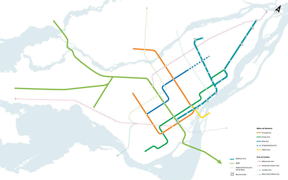
Five proposed or underway rail projects are set to transform Montreal's metro map from Pointe-aux-Trembles to the West Island.
The interactive map below shows what it could all look like if all extensions and new lines were completed as they're currently proposed.
Click on the little arrow icon in the top left of the map to view the menu and toggle between individual transit projects.
Note that all routes are approximate. Moreover, because the REM de l'Est, tram to Lachine and western extension of the orange line are either still in their early planning stages or just preliminary proposals, their courses on this map do not represent finalized concepts.
Rather, they're meant to give you a general idea of the neighbourhoods they're intended to serve.
The REM de l'Est is still undergoing consultation and there's debate about what course it should take. The route on this map is roughly based on a map that can be found online.
In January 2021, the borough of Lachine released a number of route proposals for the tram that would link it to the Sud-Ouest. This map's pink line is just one such proposal.
The City of Montreal began advocating for this two-station extension of the orange line to Bois-Franc in February 2020.
The other lines on this map represent:
- the existing metro system;
- the under-construction Réseau express métropolitain (REM), including branches to Deux-Montagnes, the West Island and YUL Montréal-Trudeau Airport;
- and the under-construction extension of the blue line to Anjou.
